
[ad_1]
CNN
—
Over 62 million are at risk of severe weather Wednesday as a major tornado-spawning storm system treks across the Central US, threatening more damage ahead after battering Iowa, Illinois, Missouri and Michigan.
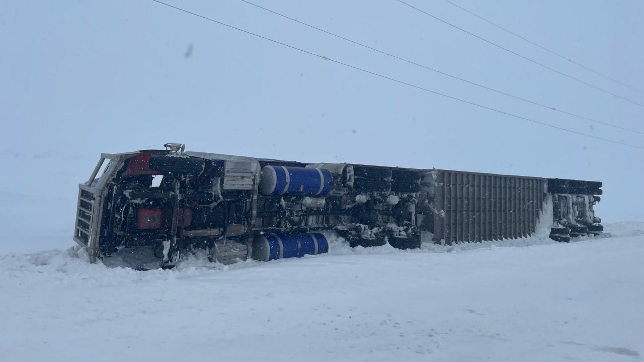
At least five tornadoes were reported Tuesday, including two in Iowa and three in Illinois, where several buildings, including a gas station, were damaged in the town of Colona and multiple semi-trucks blown over along the I-88.
The most notable impact has been large, baseball-sized hail. There were over 100 hail reports mainly across Iowa, Illinois, Missouri and Michigan Tuesday. Davenport, Iowa, was pelted with 4-inch hail – just larger than a softball – while Oswego received smaller, baseball-sized hail.
“Worst hail I’ve ever heard in Davenport. Sounded like bricks hitting the roof,” Davenport resident Paul Schmidt wrote on Facebook.
Dangerous nighttime tornadoes were still possible overnight in parts of Arkansas, Oklahoma and southern Missouri – areas already reeling from last week’s devastating tornado damage and storms that killed 32 people.
A “confirmed large and extremely dangerous tornado” was reported near Glenallen, Missouri, early Wednesday, the National Weather Service in St. Louis said. Glenallen is about 35 miles west of Cape Girardeau and the storm was expected to pass north of the city.
A tornado warning was also issued early Wednesday near Hardy, Arkansas, where the weather service reported the storm had produced “a large and extremely dangerous tornado.” Hardy is about 60 miles northwest of Jonesboro, Arkansas.
The area was included in a tornado watch that was issued for over 2 million people in parts of central and northern Arkansas, southern Illinois, and southeastern Missouri until 9:00 a.m. – including in Little Rock, Arkansas, which sustained heavy damage last week and has been clearing debris for days.
“It’s tough to think of the possibility of another round of severe weather in the midst of this recovery, but we must remain vigilant and prepared,” Little Rock Mayor Frank Scott, Jr. said in a statement. “Especially, in our already hard-hit neighborhoods, please have a plan in place to stay save, and avoid staying overnight in damaged structures.”
A separate tornado watch was issued for portions of eastern Oklahoma, western Arkansas, and northeastern Texas until noon, the Storm Prediction Center said. The watch includes Fayetteville and Fort Smith in Arkansas, and Texarkana, Texas.
“Thunderstorms forming along and ahead of two merging cold fronts will pose a threat for all severe hazards: wind, hail and tornado,” the storm center said.
An enhanced risk of severe storms, level 3 of 5, is forecast from northeastern Arkansas to northern Ohio and central Michigan, stretching from Detroit to Memphis, where residents may need to brace for strong tornadoes, damaging wind gusts and large hail.
Storms are expected to continue through the morning Wednesday and redevelop during the afternoon. The greatest threat will be over the Great Lakes region, including Chicago, Detroit and Indianapolis, where strong tornadoes are possible from late morning into the early evening hours.
“Weather conditions in these areas could be life-threatening at times, and those in affected areas should pay close attention to the local NWS Weather Forecast Office for Advisories, Watches, and Warnings,” the weather service warned.
Excessive rainfall totals of 1-3 inches are also possible from eastern Texas to southern Ohio.
Even as twisters threaten the Midwest and South, winter storms are expected to plague the Northern Plains. The region is forecast to be hit by a blizzard Wednesday, a day after “blizzard conditions” led to the shutdown of more than 100 miles of Interstate 90.
Widespread heavy snow totals are expected from the northern Rockies to the northern Plains.
“Some April snowfall records will be challenged in the Dakotas and northwest Minnesota, and the highest totals may locally exceed two feet,” the National Weather Service said.
Heavy snow and strong winds will also combine to create widespread blizzard conditions with near zero visibility, making travel dangerous to impossible.
“Cold temperatures will feel even colder due to the strong winds, and life-threatening wind chills below zero are forecast in the northern Plains,” the National Weather Service said.
The North Dakota Department of Transportation urged drivers to stay off the roads, warning that conditions are too dangerous even for emergency crews.
“If you don’t need to drive, stay off the roads. It’s dangerous for you and emergency crews. If you’re stranded, crews may not be able to reach you,” the transportation department tweeted.
[ad_2]
Source link